Layers
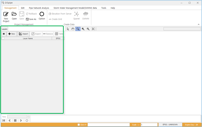
The green shot segment is the layer area.
1 Menu
- It is a function that can add background layers, waterworks layers, and sewerage layers.
- Click on the Menu button and a window will appear as shown below.
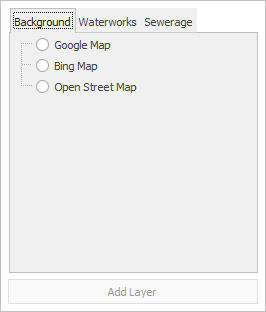
1.1 Background layer
- Background layer function is a function that can use satellite images as background on a map.
- The layer types include Google's GoogleMap, domestic portal site Daum, MicroSoft's BingMaps, Department of Land and Transport's Volkswagen and OpenStreetMap.
1.2 Waterworks layer
- Empty layers such as waterworks facilities that are needed to create a network map are added.
1.3 Sewerage layer
- Empty layers such as sewage facilities that are needed to create a network map are added.
2 New
- This function creates new documents for EPANET or SWMM.
3 Import
- It is a function to import GIS waterworks and sewage facilities data or EPANET INP, NET or SWMM INP.
3.1 Supported Format
- ESRI Shape File.
- AutoCAD DXF File.
- Epanet NET 또는 INP File.
- SWMM INP File.
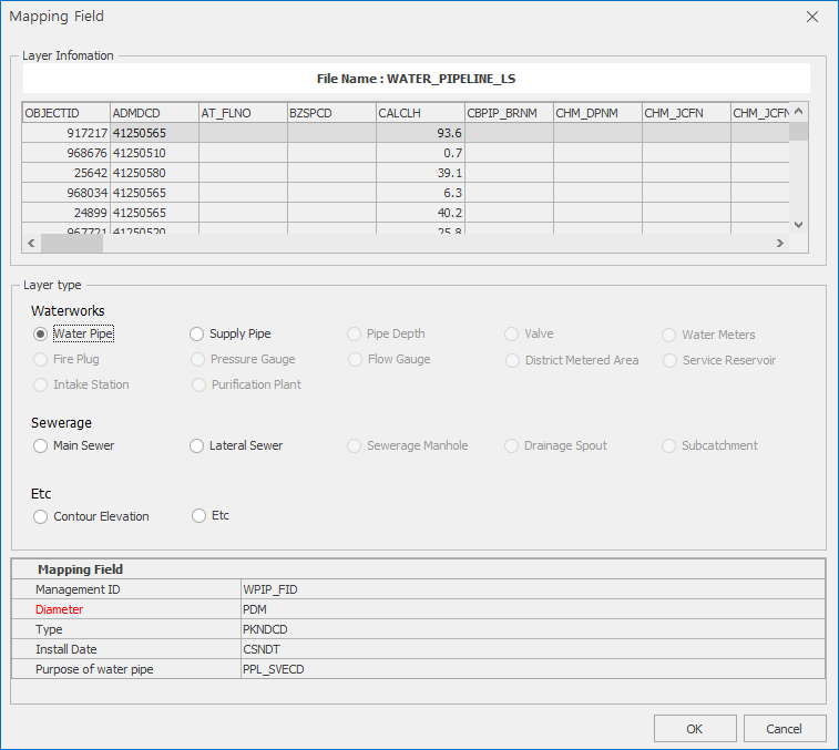
3.2 Field Mapping
- After importing a GIS file, a field mapping window appears.
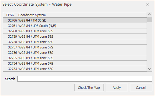
4 Specify coordinate system
- If the added layer does not have coordinate system information, it is indicated that the layer EPSG item is unknown.
- Without coordinate system, server elevation data or background layers may not appear.
- To specify a coordinate system, select the desired layer in the Layers pane and right-click and click Specify Coordinate System menu.
- If you do not know the coordinate system, add a background map and click on the Specify Coordinate System menu.
- Select the desired coordinate system and click the OK button on the map to come up with the background map and check that it is the correct coordinate system.
- You can find and apply the search function. (EPSG Number or Name of country).
5 Export
- A function to export selected layers.
- The layer of waterworks and Sewerage facilities is exported to ShapeFile.
- EPANET layers are exported to INP, NET, ShapeFile files.
- SWMM layer supports exporting to an INP file.
6 Remove Layers
- 선택된 레이어를 삭제하는 기능이다.
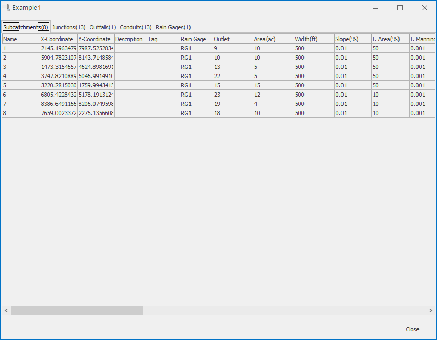
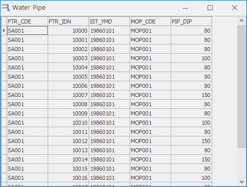
7 Table
- This function shows the attribute data of the selected layer in a table form.
7.1 EPANET Layer
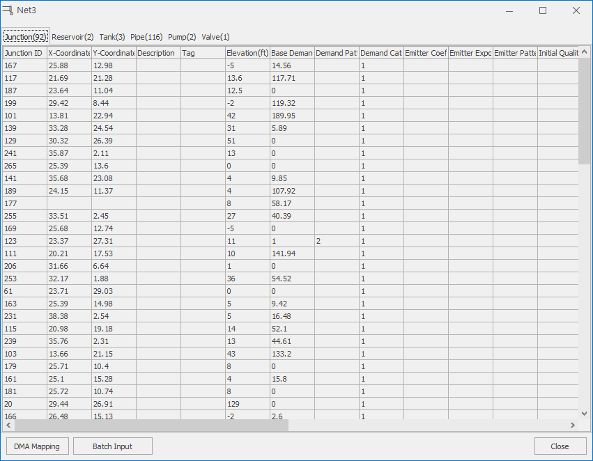
7.1.1 DMA Mapping
- The pipe network included in DMA is also a function that is assigned to components.
- To use this function, you must have a DMA boundary layer.
- This function is mainly used for entering DMA specific statistics or patterns.
7.1.2 Batch Input
- This function enters data collectively into a table.
- Select a column to input and click on the batch entry button, which opens a window for entering values, as shown in the figure below.
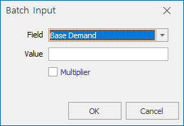
- An advanced button appears when selecting emitter of edge, water leakage of pipe.
- When you enter the total flow rate to distribute, the flow rate is allocated according to the pipe line ratio.
7.1.3 Popup Menu
7.1.3.1 Select in map
- After selecting the desired heat, click Select on Map to select a shape on the map.
7.1.3.2 Move Location
- Once the user has selected the desired heat, click Move to move to a position on the map.
7.2 SWMM Layer
7.3 GIS Waterworks or Sewerage Facilityes Layer
8 Layer properties and movements
- Double-clicking a layer opens the layer properties window.
- You can change the position of the layer by dragging and dropping it up and down.